
SpaceX launches Starship on another test flight, this time with the most advanced Starlinks


SpaceX launches Starship on another test flight, this time with the most advanced Starlinks
View 101 times
Final contenders revealed for 2026 Astronomy Photographer of the Year competition. Four miles from the Eiffel Tower, a photographer captured the full moon’s path over a pink Paris skyline. In China, another photographer snapped a night sky of falling stars.
These are just two of the submissions short-listed in the 18th annual Astronomy Photographer of the Year competition. Organized by the Royal Observatory Greenwich, the competition drew nearly 4,000 submissions from 769 photographers in 66 countries. Entries include photographs of auroras, galaxies and landscapes of Earth’s moon.

View 103 times
#WASHINGTON — More than two dozen major #NASA projects say they have been affected by the loss of a fifth of NASA’s civil servant workforce in the last year, raising concerns about delays and cost increases.
The Government Accountability Office, in a July 23 report assessing NASA’s major projects in development, said that 25 of the 36 projects included in its study reported feeling effects from last year’s departure of 22% of the agency’s civil servants through deferred retirement programs.
“The civil servant departures have left NASA’s workforce out of balance with NASA’s programmatic needs,” the GAO stated in its report.
The report included several examples of science and exploration projects dealing with the loss of personnel. Orion, for example, lost 10% of its civil servants, and officials said they faced “challenges in filling several key positions,” although other agency officials said they took steps to mitigate those concerns. The Space Launch System program lost nearly 20% of its civil servant workforce, and the program is now considering adding workforce as a formal risk to the program.
Another example in the report was DAVINCI, a Venus mission led by the Goddard Space Flight Center that suffered the loss of key personnel as well as the threat of cancellation in NASA’s fiscal year 2026 budget request. The mission was not able to immediately replace those personnel and had to revise planned risk-reduction activities for the mission as a result. DAVINCI was funded in the final fiscal year 2026 appropriations bill, allowing the project to restore staffing, but it is among the dozens of missions facing cancellation in the administration’s fiscal year 2027 budget request.
Goddard is the NASA center hardest hit by the workforce reductions, losing 34% of its civil servants. NASA Headquarters suffered the fewest losses, at 11%. Other centers reported reductions of between 16% and 28% in their civil servant workforces.
View 111 times
SpaceX moves Starship launch attempt to Thursday

View 134 times
#FAA closes Starship review ahead of SpaceX’s next test flight this week. WASHINGTON - The U.S. Federal Aviation Administration on Monday closed its review into a SpaceX Starship booster’s return failure that occurred during a flight test in May, clearing the way for Elon Musk’s space company to launch the rocket’s next test flight from Texas as soon as this week.
Reporting by Joey Roulette

View 166 times
#Japan releases snowman-like asteroid image after flyby. #TOKYO, Japan - Rare images taken by a Japanese space probe during a flyby of a near-Earth asteroid have revealed that the space rock resembled a snowman, scientists said on Monday.
The fridge-sized Hayabusa2 skimmed asteroid Torifune on Sunday in a mission that demonstrated the ability to deflect a potentially dangerous space rock away from Earth.
A new image released by the Japan Aerospace Exploration Agency (JAXA) on Monday could aid such efforts, as researchers say near-Earth asteroids vary in their size, shape and surface characteristics.
“The moment I actually saw this image and the scientific data -- it really gave me goosebumps,” JAXA scientist Yuya Mimasu told reporters, adding the asteroid “personally looked like a snowman”.
The black-and-white image, captured by a telescopic camera, showed what appeared to be two round objects joined together.
“You can actually see the rocks... I really hadn’t expected to be able to take a photo like this, so I’m absolutely over the moon,” he said.
The mission follows NASA’s successful 2022 test that changed the orbit of the asteroid Dimorphos by deliberately smashing it with a spacecraft.
Torifune was known to have an elongated shape, but its details were unknown.
Moving at a speed of more than 18,000 kilometres per hour, the probe was due to fly within 800 metres of the asteroid, but JAXA said they would analyse the distance later.
If confirmed, the mission would be one of closest flybys of a near-Earth asteroid ever.
JAXA also said on Monday they succeeded in acquiring data from three other devices which can measure the distance from the asteroid and examine the existence of water.
JAXA and the European Space Agency have teamed up on another so-called “planetary defense” mission to explore the asteroid Apophis, which will pass close to Earth in April 2029.
Launched in 2014, Hayabusa2 has already thrilled scientists by landing on and gathering material from the asteroid Ryugu, some 300 million kilometres from our planet.
Six years later, it returned to Earth precious samples from Ryugu -- “dragon palace” in Japanese -- providing scientists with clues about what the solar system was like at its birth some 4.6 billion years ago.
After the Torifune mission, the space probe is expected to attempt in 2031 a “rendezvous” -- a manoeuvre where it flies alongside or touches down on a space rock to gather detailed data -- with an asteroid called 1998KY26.

View 214 times
#Astronaut Jeremy Hansen leaving #Canadian Space Agency. A statement released by the agency today said Hansen will pursue “new professional opportunities” as of September.
He will continue to serve as a reservist with the Royal Canadian Air Force.
“This unique position is a deliberate launch pad designed to leave the door open for creative, ongoing ways to support and enable the vital work happening in Canada with respect to space, and I’m excited for the new challenges it will bring,” Hansen said in a social media post on Monday.
Hansen said the future depends on a “fierce” continuation of Canadian innovation and exploration in space.
“The technological breakthroughs and economic benefits born from this sector are vital for our country and the world, and I am as determined as ever to push that work forward,” he said.
The four-person Artemis II crew — commander Reid Wiseman, pilot Victor Glover and mission specialists Hansen and Christina Koch — were the first human beings to go around the moon in more than 50 years.

View 215 times
Super typhoon ‘Bavi’ nears U.S. Pacific islands. Howling winds and lashing rains battered Guam and the Northern Marianas late Sunday hours before the projected arrival of a “super typhoon” with equivalent force to a category-5 hurricane over the U.S. Pacific territories.
Super Typhoon Bavi was forecast to roar westwards over the area early Monday with maximum sustained winds of up to 280 kilometres (173 miles) per hour and gusts of 333 kmh, according to the Joint Typhoon Warning Center.
The National Weather Service (NWS) called the typhoon “very dangerous”, warning of possible “catastrophic wind damage” near the eye as well as storm surges and “hazardous” surf.
Already on Sunday afternoon, there were few cars on the roads in Guam or the Northern Marianas -- between them home to some 210,000 people -- with police driving around warning people to take care.
Pinky Cubacub, 55, said as she boarded up the windows of her eatery that she had lined up early on Saturday to buy US$500 worth of plywood at a lumber store.
“I cannot afford to lose so many days. It hurts,” she told AFP.
Call center employee Arabella Paulino, 48, said: “My girls were saying to me it’s scary. But it will be okay.”
“My house is concrete, so the worst that can happen is a window could blow in,” she told AFP.
Japanese tourist Miku Sakurai, 25, was supposed to fly back to Tokyo with her friends but their flight was cancelled.
“We will stay in the hotel when the storm comes. I am scared,” the office worker told AFP.
Around a dozen surfers, however, were making the most of the windy conditions at one beach in Guam’s Talofofo Bay.
“There’s quite a lot of debris in the water but it’s a lot of fun,” said one of them.
- ‘Praying’ -
The Northern Marianas in the western Pacific has a population of around 40,000, and nearby Guam -- a separate U.S. territory, although both are part of the Marianas archipelago -- about 170,000.
Super Typhoon Sinlaku, which hit the region in mid-April, knocked out power for tens of thousands of inhabitants, uprooted trees, overturned cars and ripped metal roofs off buildings.
In 2023 another massive typhoon, Mawar, the biggest in decades, caused devastation too.
Bavi was forecast to pass nearest the small island of Rota, the southernmost part of the Northern Marianas, at around 8:00 am on Monday (2200 GMT Sunday), the NWS said.
If Bavi tracks near or over Rota, home to around 1,500 people, most of the area “will be uninhabitable for weeks, perhaps longer. Many non-concrete, non-reinforced homes will be destroyed, with total roof failure and wall collapse,” it said.
“Nearly all trees will be snapped or uprooted and power poles downed. Fallen trees and power poles will isolate residential areas. Power outages will last for weeks to possibly months.”
“By working together and taking the necessary precautions, we can help protect our families, neighbors and community. We pray for the safety of our people,” Rota mayor Aubry Hocog said.
- El Nino -
The world’s oceans experienced their hottest June on record and could set fresh highs in the months ahead, the European Union’s Copernicus Marine Service said on Wednesday.
Warmer oceans help tropical storms to intensify and add more moisture, which can fall as heavy rain.
The World Meteorological Organization warned on Friday that El Nino, which typically occurs every two to seven years and lasts nine to 12 months, has already begun in the tropical Pacific and is likely to be strong.
The natural climate phenomenon warms surface temperatures in the central and eastern equatorial Pacific Ocean, bringing worldwide changes in winds, pressure and rainfall patterns.

View 220 times
India’s attempt to fire up its fledgling private space program is showing early signs of success

View 239 times
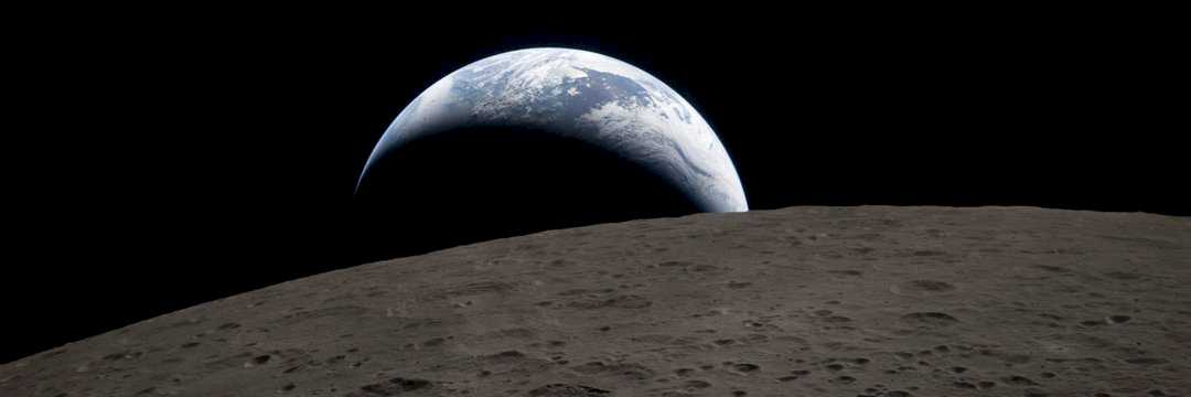
#NASA makes moves to dodge costly delays on its path to build a US$30 billion moon base. NASA’s moon base plans, conceptualized just a few months ago, are rolling out in earnest as the space agency maps out a strategy to deliver landers, rovers, buggies and other assets to the lunar surface.
On Tuesday, NASA said it will pay about $590 million dollars to three companies — Astrobotic, Firefly and Intuitive Machines — for four missions to deliver science instruments and other cargo to the moon. Astrobotic was the only vendor to be awarded two missions.
The agency also floated the possibility of repurposing a Mars rover, nicknamed Promise, for use on the moon.
These moves support a broader effort to use robotic vehicles to build up infrastructure that can be used by future human explorers on the moon.
The deals announced Tuesday are components of what Carlos García-Galán, NASA’s program executive for the moon base, called “Phase 1” of a plan to build out a permanent lunar settlement where astronauts will live and work. This initial phase is expected to last through 2028 and cost about $10 billion.
NASA announced other deals under the first phase of the program last month, including plans to rename three previously contracted missions as “Moon Base” specific. The agency also awarded additional contracts in May — worth over $1 billion altogether — for building buggies to drive on the lunar surface and deploying drones to the moon to help map a moon base location, perhaps as soon as 2028.
Phases 2 and 3 — which include plans to build the first pressurized habitats on the moon and install power generators — lay out NASA’s vision to continue building up its moon base in the 2030s. Eventually, NASA says it hopes astronauts will live and work in “semi-permanent” settlements.
It’s all part of the space agency’s plan to compete with China, whose space program has taken dramatic strides over the past decade. Lawmakers continually warn China’s efforts are threatening to eclipse the United States’ technological supremacy in space.
Navigating setbacks
Still, NASA is already facing clear headwinds.
Blue Origin, the space outfit founded by Amazon’s Jeff Bezos, was set to deliver a prototype of its massive robotic lander, called Blue Moon, to the lunar south pole later this year. The south pole is highly coveted because it is believed to be home to stores of water ice, which can be converted to rocket fuel or drinking water.
But Blue Origin suffered a major setback in May when one of its New Glenn rockets abruptly exploded on the launchpad, destroying vital infrastructure that will take months to rebuild. It’s not clear how long the Blue Moon launch may be postponed as a result.
On Tuesday, García-Galán hinted that the Blue Moon lander may launch on a different vehicle if needed, saying NASA is “looking at other options” in case Blue Origin’s rocket and launchpad work doesn’t meet the agency’s timeline.
NASA Administrator Jared Isaacman made clear in a social media post shortly after the New Glenn incident that the space agency intends to be hands-on with its private-sector partners when hurdles arise.
“We have been saying for months at NASA that we are not going to sit on our hands and wait for the capabilities necessary to achieve the nation’s most pressing objectives,” Isaacman said. “We are going to take an active role alongside our partners, just as we did in the 1960s, to overcome setbacks, remove obstacles, and deliver the intended outcomes.”
US$30 billion questions
Blue Origin is far from NASA’s only partner, though its Blue Moon lander is substantially larger than most other robotic crafts and is expected to come in two versions — including one for carrying crew. SpaceX is also working to develop its Starship rocket for astronaut transportation to and from the moon, though the massive vehicle is not yet operational.
But NASA has a field of other players to tap for delivering cargo to the moon’s surface. Texas-based Firefly is so far the only company to carry out a wholly successful mission, landing its Blue Ghost vehicle near the lunar equator last year. Texas-based Intuitive Machines has also twice put landers near the south pole of the moon, though both times the landers tipped over.
NASA’s flurry of announcements and presentations this year about building a moon base are designed to encourage and spur more innovation from private-sector partners, García-Galán said.
“If you are in industry and wondering if you need to make that investment to increase your high bay, to increase the number of supply chain vendors that you have — this is the signal to say: We’re here to stay with this demand, and we’re building a moon base,” he told CNN during the Space Symposium conference in April.
In total, #NASA said it expects the moon base to cost about $30 billion.
The moon base is integral to NASA’s Artemis program, which has so far already cost roughly $100 billion and to date has consisted of one uncrewed test mission and the historic crewed lunar flyby in April. Now, the space agency is now gearing up to send humans back to the moon’s surface for the first time in five decades and eventually build a settlement there. Both the US and China have plans to establish lunar outposts.
Members of Congress on both sides of the aisle have bolstered efforts to fund lunar exploration by warning about competition with China.
And even as the Trump White House has recommended slashing NASA’s science budget by nearly 50%, the administration has sought to boost funding for the moon base in order to “establish U.S. dominance.”
But there’s a long way to go. The path to establishing a permanent lunar settlement is rife with technological, political and ethical questions.
Experts warn that there is currently a dramatic lack of infrastructure on the moon to support such a colony. Even the matter of keeping the correct time on the moon has not been solved for, as seconds tick by slightly faster on the moon than here on Earth.
And the funding landscape remains fuzzy. Trump’s Big Beautiful Bill gave about $10 billion to NASA to be doled out over six years, but much of those funds are earmarked for specific purposes. About $2.6 billion of that was slated to build a lunar space station, called Gateway, but NASA abruptly shelved those plans in March, saying the resources would be better spent building infrastructure on the surface rather than in lunar orbit.
By Jackie Wattles, CNN

View 253 times


Space news on Umojja.com